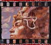
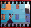
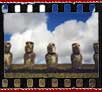
|
It's
the multiple layers of great civilisations which
makes Peru so fascinating. You can wander around
colonial cities which have preserved the legacy
of the Spanish conquistadors, visit the ancient
Incan capital of Cuzco, explore the lost city
of Machu Picchu and ponder the enigma of the Nazca
Lines.
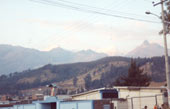
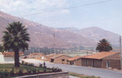
Coming
from Copacabana in Bolivia at lake Titicaca next
stop was Puno, a small village placed at
Lake Titicaca but on the Peruvian Side.
|
|
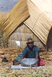
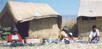
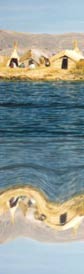
Even
though it has become overcommercialised, the Floating
islands of the Uros people is a unique phenomenon.
Always a small tribe, they began to isolate themselves
from the Collas and the Incas. About 300 people
live on the islands. To create their 'islandhomes',
they havest the totora reed, which grows in the
shallows of Lake Titicaca, and place the reed
in many layers. The layers rot away from the bottom
and are replaced on top.
|
 |
|
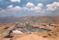
You and continue the trip to thewest to Arequipa
that is surrounded by spectacular mountains, including
the volcano El Misti. A feature of the city is its
many beautiful buildings made of a light-coloured
volcanic rock called sillar. |
|
You
don't have to be in Peru too long to realise that
the 'New World' had a rich and complex cultural
life thousands of years before Pizarro turned
up wearing funny clothing. All of this exists
in a country with some of the most spectacular
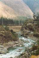
and varied scenery in South America. The Peruvian
Andes are arguably the most beautiful on the continent
and the mountains are home to millions of highland
Indians who still speak the ancient tongue of
Quechua and maintain a traditional way of life.
|
The
Inca Empire
The
Incas developed the most sophisticated of
South America's precolumbian highland civilisations.
In it's greatness it existed barely a century
until about 1430. It stretches from northern
Ecuador to central Chile, traversing the
Andes with over 8000 km of highways, but
never able to get deep into the Amazon lowlands.
At its peak time, the time of the Spanish
invasion, the Empire governed at least 12
million people. Despite of the this overextended
empire it was vulnerable enough to get conquered
by the Spaniards.The Empire's 'heart' is
the valley of Cuzco, were several Inca ruins
still remain. The most famous and spectacular
one at Machu Picchu - also known as the
'Lost City of the Incas'.
|
 |
|
Cuzco,the old imperial Inca capital,
being both the administrative and religious
centre of the empire is the starting point
for the famous Inca
Trail, which is the most
popular hike in whole South America where
you end up at the 'Lost City'.
|
|
Cuzco
was seized by the Spanish in 1533 after
the murders of the Incas
|
 |
| Huascar
and Atahualpa, many of the original Inca buildings
were destroyed and their stone used to construct
palaces and churches for the invaders. Much
of the city was also burned during the rebellion
of 1534. |
|
The
Inca Trail
88km
by train out of Cuzco starts the trail,
when you want to hike for 4 days.
|
|
|
|
Cactus |
|
|
|
|
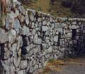
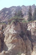
The
very start of the Inca trail... |
|
|
| |
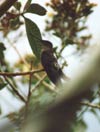
A
hummingbird |
One
ot rhe fist ruins on the way
|
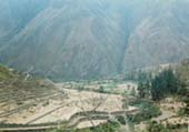
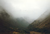
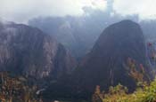
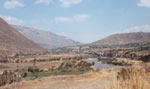
| Looking
into the Valley
of the Andes
|
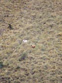
Some
lamas
|
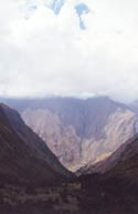
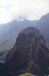
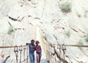
| Still
a long way infront...
|
|
It's
foggy at this altitude |
|
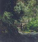
A
cosy little spot in between the greens
|

Another
ruin -looking like an amphietheatre
|
|
|
|
|
Peru's
climate can be divided into two seasons - wet
and dry - though this varies, depending on the
geographical region. The coast and western Andean
slopes are generally dry, with the summer falling
between December and April; during the rest of
the year, the garúa (coastal fog) moves in and
the sun is rarely seen. In the Andes, the dry
season is from May to September, while the wet
season takes up the remainder of the year. On
the eastern slopes of the Andes, the drier months
are similar to the highlands, though the wet season
(January to April) is more pronounced.
When
to Go Peru's peak tourist season is from June
to August, which is the dry season in the highlands,
and this is the best time to go if you're interested
in hiking. Travellers do visit the highlands year-round,
though the wettest months, January to April, make
trekking a muddy proposition. Many of the major
fiestas occur in the wettest months and continue
undiminished in spite of heavy rain. On the coast,
Peruvians visit the beaches during the sunny months
from late December through March, although few
beaches are particularly enticing. The rest of
the year, the coast is clothed in mist. In the
eastern rainforests, it naturally rains a lot.
The wettest months are December through April,
though travellers visit year-round since it rarely
rains for more than a few hours and there's still
plenty of sunshine to enjoy.
Lima
and Cuzco are the most expensive places in the
country. If you're on a tight budget, you can
scrape by on around $US20 per day, but if you
want to stay in modest hotels and eat out at restaurants,
you'll have a better time on around $US50 a day.
The easiest currency to exchange is US dollars.
Other currencies are only exchangeable in major
cities and at a high commission. Money can be
changed in banks, casas de cambio, first-class
hotels, or with street changers. Casas de cambio
are usually the easiest places to change money.
Street changers, who hang out near banks, never
offer better rates than the best bank rate and
have been known to cheat travellers so are best
avoided.
Taxi
drivers are not tipped - bargain hard beforehand
and stick to your price. Local guides should be
tipped between US$3 and US$5 per day. Bargaining
is accepted and expected in markets.
The verdant Amazon Basin, which occupies half
of Peru, is one of the world's top ten biodiversity
`hot spots' - a species-rich area of tropical
rainforest that will make your head spin when
you start to learn about its ecology.
And
the coastal deserts, with their huge rolling dunes,
farmland oases and fishing villages, are under
appreciated by travellers but offer the opportunity
to get off the Gringo Trail in a big way.
But
you don't have to be a zoologist, an anthropologist
or a mountain climber to enjoy Peru, all you need
is a keen eye, a love of landscape, an interest
in history and a very good money belt.
|
|
|
|
Facts
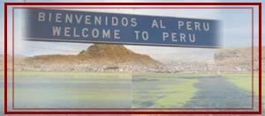
Peru
is in western South America and shares borders
with Chile (to the south), Bolivia (south-east),
Brazil (north-east), Colombia (north) and Ecuador
(north-west). It has three major regions: a narrow
coastal belt, the wide Andean mountains and the
Amazon Basin. The coastal strip is predominantly
desert, but contains Peru's major cities and its
best highway, the Carratera Panamericana. The
Andes comprise two principal ranges - Cordillera
Occidental and Oriental - and includes Huascarán
(6768m), Peru's highest mountain. To the east
is the Amazon Basin, a region of tropical lowland,
which is drained by the Maranon and Ucayali rivers.
Bird and marine life is abundant along Peru's
desert coast, with colonies of sea-lion, the Humboldt
penguin, Chilean flamingo, Peruvian pelican, Inca
tern and the brown booby endemic to the region.
Common highland birds include the Andean condor,
puna ibis and a variety of hummingbird. The highlands
are also home to cameloids such as the llama,
alpaca, guanaco and vicuña, while the eastern
slopes of the Andes are the haunts of jaguars,
spectacled bears and tapirs. Peru's flora contains
a number of hardy and unique plants, including
patches of Polylepis woodland found at extreme
heights. The vast wealth of wildlife is protected
in a system of national parks and reserves with
almost 30 areas covering nearly 7% of the country.
|
|
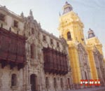
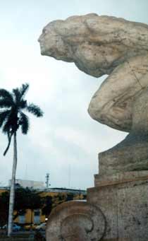
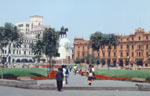
Lima,
Peru's capital (pop: over 7 million), is overcrowded,
polluted, noisy and often has wretched weather.
Nevertheless, the inhabitants are friendly and
hospitable, opportunities for dining and nightlife
are ample
|
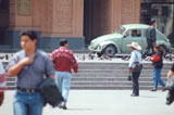
| At |
| the |
| main |
| plaza |
| in |
| Lima |
|
and the city has a great selection of museums.
A project is now underway to restore the city's
colonial centre, so Lima may be a lot lovelier
in the near future. Attractions include the Museo
de Oro del Peru, which has numerous artefacts
of gold, silver and precious stones, and the Museo
 |
Nacional
de Antropología y Arquelogía, which is noted
for its excellent exhibits of prehistoric
Peru.Churches such as San Francisco (famous
for its catacombs) and Santo Domingo (circa
1540) |
provide a welcome respite from the outside clamour.
Lima's many markets, including Polvos Azules, overflow
with consumer goods and handicrafts.
There
are also plazas, lovely colonial buildings and
a zoo. Inexpensive accommodation can be found
in the city centre. The suburb of Barranco has
a number of cheap restaurants and live music venues
and is very popular with backpackers. The suburb
of Miraflores has the city's best stores, restaurants
and nightspots.
Warning
Lima and traditional tourist areas such as Cuzco
and Machu Picchu are considered safe, but care
should be exercised at all times.
| The
following photographs derive from the Huaraz
Area (North Peru) |
 |
 |
| Me
and a perivian guy on tour in the Huaraz Mountains |
 |
 |
| The
Huaraz Area is harsh and dry climate |
 |
| Though
poor conditions prevail, it's beautiful sceenery. |
|
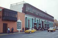
| The
North Coast - Trujillo, 560 km north of Lima,
is northern peru's main city. it's an active town,
founded in 1536 by pizarro and it's retaining much
of its colonial flavour. |
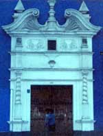
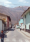
The
colonial houses in Trujillo
|
At
the plaza
|
|
|
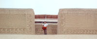
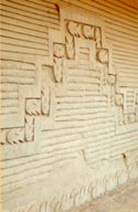
| The
design og Chimú |
|
|
|
Nearby
are the 1500-year-old Moche Pyramids of the Sun
and the Moon and the ancient Chimú capital
of Chan Chan, which preceded the incas.... there
are also some pleasant beaches, like the beach
at the fishing village Huanchaco has the best
beach in this area.
|
|
|
|
Chan
Chan was build around 1300 AD and contained
about 10,000 dwellings. the royal dead were buried
in mounds containing a wealth of funerary offerings.
The whole city was decorated with designs moulded
into mud walls and ther more important areas were
layered with precious metals. the Chimú
were conquered by the Incas around 1460, but the
city was not looted until the Spanish arrived.
The Chimú capital consisted of nine subcities,
called the Royal Compounds. Today you only see
ahuge area of crumbling mud walls, some dekoratedwith
marvellous frieze. The treasures are gone...
|
|
|
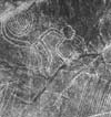
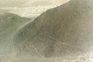
The
Nasca Lines
Is it
Ancient religion, ancient astronomers, water
sources? Or Aliens from outer space? Since
discovery by American scientist Paul Kosok
in 1939, the Nazca lines on the rocky Pampa
San Jose near the small desert town of Nazca
remain one of humanity's mysteries.
|
 |
| They
are the most outstanding and impressive
group of geoglyphs in the world, because
of their numbers, characteristics,dimensions
and cultural continuity as |
|
|
they
were made and remade through out the whole
prehispanic period.
The
lines are a variety of geometrical figures
and animal. They range in size up to 1000
ft (300m) across and are about 2000 years
old. They were built by a people called
the Nasca Though they have survived 2000
years of wind and occasional rain, the lines
on the desert floor cannot withstand pedestrians,
horses and vehicles. The Nazca Lines are
now a UNESCO World Heritage Site and one
of the most popular tourist destinations
in Peru.
|
| Many
theories about the origin of the lines
have been propounded. |
|
 |
|
What theory is to believe?
The
best viewing of the lines are from the air.
They are located in the Pampa region of
Peru. The Lines were first spotted when
commercial airlines began flying across
the Peruvian desert in the 1920's. Passengers
reported seeing 'primitive landing strips'
on the ground below. No one knew who had
built them or indeed why.
|
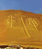 |
| The
Nazca plain is virtually unique for
its ability to preserve the markings
upon it, due to the combination of the
climate (one of the driest on Earth,
with only twenty minutes of rainfall
per year)and the flat, |
|
|
stony
ground which minimises the effect of the
wind at ground level. With no dust or sand
to cover the plain, and little rain or wind
to erode of a lighter-coloured subsoil beneath
the desert crust, provide a vast writing
pad that is ideally suited to the artist
who wants to leave his mark for eternity.
The
concentration and juxtaposition of the lines
and drawings leave no doubt that they required
intensive long-term labor as is demonstrated
by the stylistic continuity of the designs,
which clearly correspond to the different
stages of cultural changes. All these figures
have well-defined entrances which could
be used as paths or to allow people to line
together along the conformations of the
drawings.
|
|
|
|